Bali Pass Trek Guide 2024: History, Highlights, Season and Itinerary
Table of Contents
ToggleThe Bali Pass Trek is a hidden treasure that most travelers ignore, so come and claim the beauty of this secluded trek. Forget yourself in the sheer bliss of this place as you climb 5300m through Dhumdhar. Here you will see Wildflowers, lush green meadows with novel flowers.
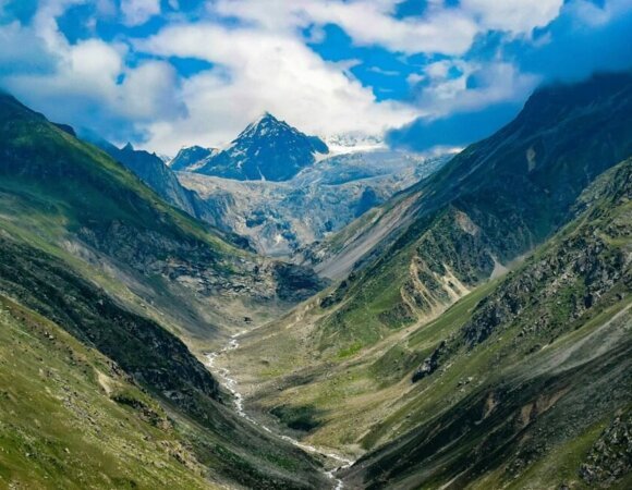
The Bali Pass is a mountain pass that reaches peaks slightly below 5,000 meters and connects the valley of Har Ki Dun Ruinsara to Yamunotri and vice versa. On this hike, you will have fun and come across hilly terrain, rough rocks, dense forests with lush vegetation everywhere, silky green meadows, snowy glaciers, and icy trails, etc.
History of Bali Pass Trek
According to Ramayana mythology, the Bali Pass is named after the king of the monkeys, Bali. Bali is said to have crossed the Himalayan mountains and defeated a demon named Odari. To pay tribute to the heroic ruler, the place is known as the Bali Pass. According to the Mahabharata epic, the Pandavas attempted to ascend to heaven from the top of Swargarohini which is called the path to heaven.

This happened after the triumph of the Kaurava Empire. Although only one of the brothers, Yudhishthira was able to reach heaven, the passage of Bali traces its paths to the civilizations of the past. The story goes back to the 1940s, when a teacher named Jack Gibson of the Doon School popularized this trek. Many hikers now enjoy their pleasures every year in the overcrowded region.
| AREA | Garhwal Himalayan Region |
| DURATION | 9 DAYS |
| BEST SEASON | May, Jun, Jul, Aug, Sep, Oct, |
| GRADE | Tough |
| ALTITUDE | 1900 – 5000 mts |
| APPROX TREKKING KM | 61 km |




Highlights of Bali Pass Trek
- Wild animals such as the Himalayan ibex and blue sheep, black bears, and brown bears can be seen on this trail seldomly.
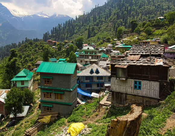
- Village of Jaunsar is often claimed as the descendants of the Pandavas. This is a small village known for its wooden houses.
- Spend time observing the lush green meadows of Dev Thach from the high altitudes.
- Meet and greet the villagers of Gangad and Osla. Learn about their culture and folklore. Osla is known for its interesting Himachali architecture.
- Seek the blessings of Lord Shiva at Yamunotri Temple, which is a part of the Chota Char Dham Trail.
- Relax at the edge of Lake Ruinsara, one of the glacial lakes.
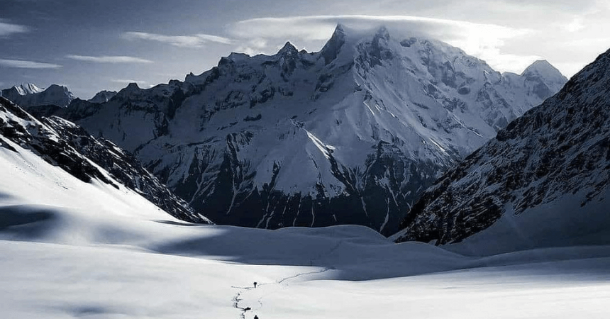
- Stunning views of the Himalayan peaks namely Swargarohini, Kalanag, and Bandarpunch.
Location of Bali Pass Trek
This high pass passes under the national park and the sanctuary of Govind Pashu Vihar. Located in the Uttarkashi district of the Uttarakhand, this is an irresistible trek that shows the breathtaking beauty of the Garhwal Himalayas.

The Bali Pass’s road distance is 66 km from Taluka to Janki Chatti. The trek is ultimately difficult as it has a maximum height of over 16,000 feet and long days of walking, with steep climbs and descents. At 4950m above sea level, Bali is a high-altitude pass, offering views of the Kala Nag, Bandarpoonch, and Swargarohini peaks. Trekking to the Bali pass is not easy; hikers will need the help of technical tools such as crampons and ropes.
Best Time to Visit Bali Pass Trek
The best time to travel the Bali Pass Trek is during the summer (May-June) and after the monsoon (September-October).
Summer: The climate of the Bali Pass remains healthy and pleasant during the summers. The Himalayas are visible and the cool breeze adds charm to the vacation.
After the Monsoon: The greenery of the Bali Pass welcomes the tourist to get lost in the wilderness. Sip your tea as you admire the snow-capped peaks of Bali Pass during the monsoon.

The roads are likely to be blocked for a few hours due to landslides, but the scenic beauty of the Bali Pass is worth the risk during the monsoon. In summer, daytime temperatures can range from 18 degrees Celsius to 25 degrees Celsius and nighttime temperatures drop from 0 to -5 degrees Celsius.
How to Reach Bali Pass Trek
The trek starts from the village of Taluka which is connected to the village of Sankri. Sankri is the last village connected by public transport.
By Road –
If you are starting your journey from Delhi, take the bus from ISBT Kashmiri Gate, New Delhi to Dehradun. Once in Dehradun, hire a taxi or if you are in a group travel by public transport. There is one direct bus from Dehradun to Sankri. Try to reach Dehradun early in the morning as the bus to Sankri village runs from 6:00 a.m. to 8:00 a.m.
By Train –
Dehradun is the closest terminus of Bali Pass which is well served by many trains from Delhi and other areas. Local buses and taxis are easily available from Dehradun station.
By Air –
The closest airport to Bali Pass is Dehradun’s Jolly Grant Airport. From there rent a taxi or take a bus to Sankri village.
Read more: Dayara Bugyal Trek
Itinerary of Bali Pass Trek
Day 1: By car from Dehradun to Sankri: 187 km
The journey starts in Dehradun. Purola, Mori and Netwar. Reach Sankri. There is no network connectivity in this village, so you can watch the sunset over the neighboring peaks of the Great Himalayas without any distraction.
STAY HERE IN THE NIGHT.
Day 2: From Sankri (1,920 m) to Seema (2,560 m) via Taluka (2,050 m)
Reach Taluka by car. The walkable path to Govind Pashu National Park finishes here, the hike begins on a stony path next to the Supin river, there are also Himalayan amaranth plantations, popularly called Cholai, in the shade of walnut, pine, deodar, and maple. In a few hours and passing a few streams, you can view the town of Gangad across the river on the left.
We continue our journey and after some time the picturesque town of Osla appears before us. Osla houses around 200 families and gives us an insight into the Garhwali culture. Seema is a small town overlooking Osla on the other side.
Day 3: Seema (2,560 m) to Roiltia (3,350 m)
From here on foot for 6 hours leaving the last human settlements behind, we resume on the right slope of the valley along the Supin River. Supin blends with Rupin near the village of Netwar to form Tons, the largest tributary of the Yamuna River.
An ascent through the deodar trees takes us to the beautiful Devsu Thatch Meadow, this 1km green stretch separates us from the Swargarohini mountain ranges, you can also see Kalanag (Black Peak) (6387m) in a straight line. On the left, we see the Har Ki Dun valley, in the background the confluence of the rivers Har Ki Dun and Ruinsara. After descending from the meadow, we will enter the Ruinsara valley.
Day 4: Waterfall to Ruinsara lake
Today’s journey will take less than 2 hours even at a slow pace. And from here on, significant change in the vegetation is visible. The dense woods that we pass through is the usual place to visit by an endangered species of Himalayan brown bear.
Day 5: Take a rest and explore Lake Ruinsara
At an altitude of around 3,500m, Lake Ruinsara is a good place to acclimate before arriving at the Bali Pass base camp the next day. The reputation of the Ruinsara Valley is chiefly because of its beauty. The pristine lake lies on a wide meadow, alpine vegetation. An infinite variety of alpine flowers grow all around the lake. Supin is 100 meters below the lake, near a ridge.
Day 6: Lake Ruinsara to Odari (4,100 m): 4 km in 34 hours
We start the day early to reach our destination before the afternoon. Come down to the shallow river, pass the opposite bank and climb to another stunning meadow – Thanga. This gorgeous lawn also gives away a majestic view of the swargarohini mountain ranges. Kyarkoti Valley is on the left.
We will soon arrive in Odari. There is a mythological tale related to this place. Bali, Hanuman’s brother also known as the king of monkeys had spent a night here.
Day 7: Odari (4,100m) to Upper Dhamni (4,000m) via Bali Pass (4,900m)
This day crossing the Bali Pass also starts very early. Try to get to the top at 8:00 am. It’s a fairly short but hard climb to the pass. Here you will come across many glacial screes. To reach the summit, time varies from 45 minutes to an hour and a half.
When we reach the top, we will see the Yamunotri valley for the first time. The view is breathtaking. You can watch the summits of the Bandarpunch from the top of the pass. The peaks of Dayara Bugyal, Barua Top, and Dokrani Bamak are also visible. Then carefully come down across a connecting ridge and reach the upper Dhamni encampment.
Day 8: Upper Dhamni to Yamunotri to Janki Chatti (2400m)
We descend further on a wooded path. This path brings us to Yamunotri Shrine temple in the Char Dham and is dedicated to the goddess Yamuna. After visiting the temple, move along the traditional path to Janaki chatti.
Day 9: Janki Chatti to Dehradun
It is the last day of the trip and we will return to Dehradun. You can visit other famous places that come under the same route such as Kempty, Nainbagh, and Mussoorie.
With equally good memories of hikes and unusual visits, we have an invaluable experience.
Frequently Asked Questions (FAQ) for Bali Pass Trek
Where is Bali Pass Trek located?
This high pass passes under the national park and the sanctuary of Govind Pashu Vihar. Located in the Uttarkashi district of Uttarakhand.
When is the best time to visit Bali Pass Trek?
The best time to go to the Bali Pass Trek is during the summer (May-June) and after the monsoon (September-October).
Summer: The climate of the Bali Pass remains healthy and pleasant during the summers. The Himalayas are visible and the cool breeze adds charm to the vacation.
After the monsoon: the greenery of the Bali Pass welcomes the tourist to get lost in the wilderness.
What will the temperatures be like during Bali Pass Trek?
During the day, the temperature will range from 5-15 degrees Celsius. The nights will get cold dropping the temperature from -2 to -5 degrees Celsius. The higher the altitude, the colder it gets.
Which season has snow on the Bali Pass Trek?
On the Bali Pass trek snow can be expected in the months of May-June. It is difficult to anticipate snow in September when the trek opens again for its second season. October is likely to get fresh snowfall at higher altitudes if the climate is favorable.
Is Bali Pass Trek difficult?
Bali Pass is a difficult trek with a high altitude of 4,900 meters or 16,076 feet. For at least 4 days of the total 7 days, the trek can be long with more than 10 KM walks. The last section is very steep, needing strength and experience. The descent has some initially challenging sections that need to be carefully crossed. From Upper Damini the trail is well laid up to Yamunotri.
What are some of the top attractions of the Bali pass trek?
Mountain Peaks such as Black Peak (6,387 m), Swargarohini Massif, and Bandarpunch Massif are visible during the trek.
The trail is known for abundant flora and fauna. Black Bears roam around in the densely forested sections, that is between Osla and Ruinsara Lake. Brown Bears live high up ahead of Thanga towards the Dhumdhar Kandi pass. Blue Sheep is another prominent species found in the area.
The pass in itself is more like a peak than a depression. The final approach to the pass is similar to the summit of a mountain peak, rewarding panoramic views.

[…] Read more: Bali Pass Trek […]
[…] Read more: Bali Pass Trek […]