Deo Tibba Trek Guide 2024: History, Highlights, Best Time and Itinerary
Table of Contents
ToggleTrekking Deo Tibba trek is undoubtedly a fulfilling and affordable with difficult terrain and challenges which adds abundance and character to the overall trekking experience in the state of Himachal Pradesh. With the summit located at an altitude of around 14,700 feet, the summit expedition begins at Manali, a popular and easily attainable hill station in the Kullu district of Himachal Pradesh that works as an easy base camp for those who travel and those who hike to the top.
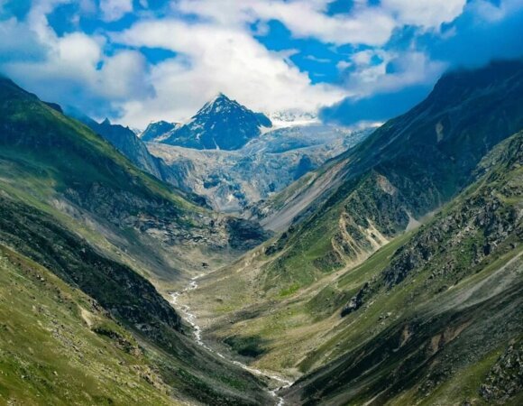
The trip to Deo Tibba is unconventional; it is one of a kind with some fun and generally steady temperature, a difficult distance spread evenly over a few days of hiking, and breathtaking and thrilling views of the sceneries of the Pir Panjal mountain range. During the journey, you will surely come across many fascinating stories told in the neighborhoods of the hamlet of Chikka, which makes the trek interesting and fairly exciting.
Thereafter, the community of Jogi Dugh, the cave of Bhandara and the view of the lake Chota Chandratal live as the highlights of the trek with a somewhat complicated ground that encourages adventure buffs to attempt into the world.
Mountaineering, starting with impenetrable birch forests, enchanting snow-covered meadows, pearly white plains, enormous glaciers; the journey remains complicated, difficult and is at a medium level in the complexity spectrum. The best time to do the Deo Tibba trek transpires between June and September when the trail favors being more satisfying and stimulating.
History of Deo Tibba Trek
Deo Tibba’s first study was executed by General Bruce’s guide Furrer, who published that one of his ridges appeared to be evolutionary from Hamta Nala. According to local faiths, Deo Tibba is the gathering place of the gods.
According to Hindu belief, the domed top of Deo Tibba is where the deities remain seated, hence the name Deo Tibba. Deo means “Gods” and Tibba means “hill”.
| AREA | Pir Panjal Range, Kullu Valley, Himachal Pradesh |
| DURATION | 5 Days |
| BEST SEASON | May to June & September to October |
| GRADE | Moderate |
| ALTITUDE | 14698 ft |
| TREKKING LENGTH | 75 km (approx) |

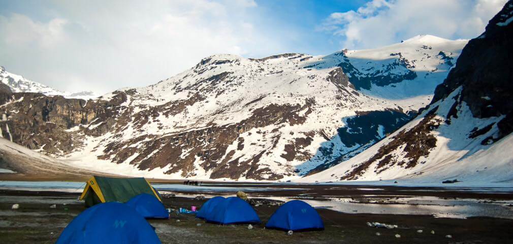

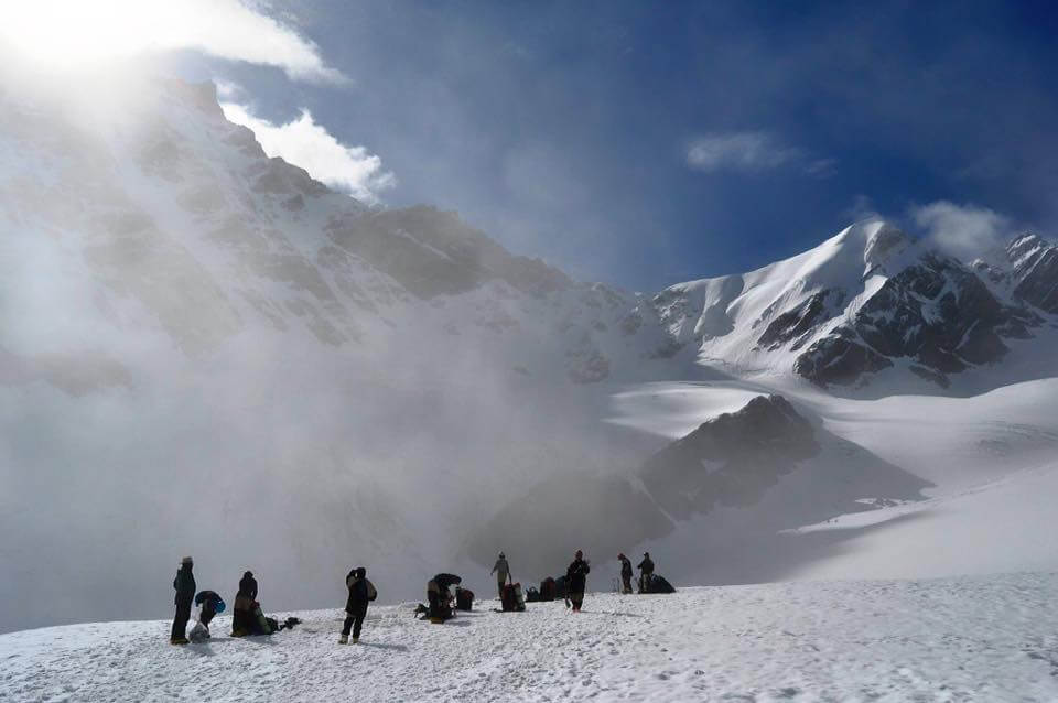
Highlights of Deo Tibba Trek
- Trekking to Deo Tibba base camp is a gorgeous hike in the Manali area.
- You cross luxurious forests of pines, spruces, firs, oaks, and silver birches in dazzling scenery.
- Hikers can relish beautiful views of many snow-capped peaks such as Deo Tibba (6001m), Norbu Peak (5226m), and Jagatsukh Peak (5050m).
- The emerald blue water of Lake Chotta Chandrataal at the base of Deo Tibba summit is the greatest climax of a trek.
Deo Tibba Trek Location
Deo Tibba at 6,001 meters is the second-highest peak in the Pir range Panjal in the Kullu Valley. The place is spiritual and is considered as the meeting spot of all gods. The hike begins beside Jagatsukh Nala to the base of Deo Tibba.
Best Time To Trek Deo Tibba Trek
The ascension and declination of Deo Tibba is difficult as hikers ascend to the top. The most suitable time to hike these trails is in May, June, October, and November months.
Unfavorable temperatures and rainfall make this trek a pre and post-monsoon trek. Temperatures generally range from 13 to 18 degrees Celsius throughout the day, with noticeably cooler nights. As the altitude increases, the weather conditions can become difficult.
How to Reach Deo Tibba Trek?
If you happen to travel from any metropolitan city in India or outside India, reaching Delhi can be the first and most significant stop. All important means of transport such as air, road, and rail can take you to Delhi. Manali is attached to the most important cities in India by all major means of transportation.
By Air
Manali Airport is the closest airport to Manali. It is well linked to Delhi and many major cities with regular flights.
By Road
Delhi has straight paths to Manali. Hikers will need to schedule a private bus or taxi. Advance booking of taxis and buses is readily available at various sites.
By Train
The closest train station to Manali will be the Manali station. Manali is connected to all major railway lines.
Itinerary for Deo Tibba Trek
Day 1: Arrive in Manali
Arrive with enthusiasm at Manali. Get ready to traverse Manali. Manali is inhabited on the bank of the Beas River. It is entirely blanketed with big pines; the climate is comfortable all year round. From here you can also see the Deo Tibba peak.
Day 2: Manali to Chika
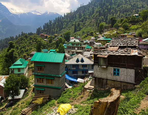
On the first day of your trek, start by a drive to Sethan, followed by a short trek to Chika. It’s astonishing to go up Jagatsukh. It is a stunning hamlet full of picturesque wood houses. Jagatsukh used to be the capital of Kullu.
The road ahead is full of rough curves. You will pass through Sethan, before Chika. After crossing the Khanual Dam, start your hike. The trekking route is done through thick woods and uphill. Stay in a tent.
Day 3: Chikka to Seri
The trail begins with a progressive ascension through a thick jungle . The trail is on the right of Jagatsukh Nala. Freshwater sources are available at Panduropa and DuduPatthar. Birch will start to welcome you into the path trailed by the wild bush. The whole dissolves into open spaces of grasslands. These are the meadows of Seri. You can see the cliffs of Tainta and the waterfalls on these rocks. Stay here for the night.
Day 4: From Seri to DeoTibba Base Camp
Today is going to be a bit difficult. The hike begins with a low path. The ascent is made on a crooked path to the Tainta cliff. You will have to cross a Stonefield. Keep walking on moraine and you shall reach Tainta field which serves as the base of the glacier. As you can imagine, the path is now over wobbly cobbles. Steps should be taken with caution. Then you will arrive at Chota Chandratal. It is a small lake in the dent of the mountain.
Day 5: Acclimatization Day
Today is to cool off and relax. You are at an altitude of 4,200 meters, it is necessary to allow a chance for acclimatization. You are able to stroll and observe sights near the site.
Read more: Swargarohini Trek
Day 6: Load the ferry toward Camp 1 (Duhangan Col)
Climbers are to bring their equipment and gear to upper camp and sleep for the night time at base camp. This shall help you with acclimatization and prevent AMS at higher altitudes. The path is complicated and begins with a modest climb followed by a flat slope.
Camp 1 is located on the Duhangan Pass. The slope lies somewhere around 4065 degrees and is packed with snow and boulders. You will be able to see exactly where the glacier starts. There exist a lot of crevasses on the iceberg so be cautious with your steps. These tracks are known for rock falls so be alert.
Day 7: DeoTibba Base Camp to Camp 1
Today you will move to Camp 1 completely. Pay attention to the rockfall zone, glaciers, and passing rocks. Make certain that you don’t get fatigue and get adequate rest. Stay in your tent.
Day 8: Load the ferry to Summit Camp
It’s the day to climb to the summit camp. The whole path would be blanketed with snow. Hence, all snow gear and apparel should be worn. Including snowfall, the tracks are challenging. In the first couple of hours, the track is moderately uphill, then everything is steep. Be careful. Kill some time at the summit, so that your body can acclimatize. Follow your steps to return to Camp 1.
Day 9: Camp 1 to Summit Camp
The whole team will now move to Summit Camp. Bring only the necessary items that you will need and leave the rest at Camp 1. Follow the same as the day before. Once you arrive at the camp, your team will notify you of the summit attempt. The night will be as exciting as the night at the top will be. Eat full and get enough rest for the summit attempt.
Day 10: Summit attempt and return to camp 1
The summit attempt will start at 2 am early in the morning. Wake up accordingly to prepare for the summit push. Check all the equipment and get ready. Cross a canal with fixed ropes. The first 300 meters are quite steep and technical while climbing.
Continue uphill on snowy slopes. You can see Indrasen Peak as you gain altitude. The slope gets steeper just before the summit. The top is actually a large, open, flat snow dome. So the last 100 meters to the top is almost a flat walk. There are also a lot of crevasses towards the end.
Day 11: Camp 1 at DeoTibba Base Camp
After the summit attempt it is now time to begin the return trip. Follow the same path to Deo Tibba base camp. It’s a steep descent so watch your steps. Try to reach base camp at lunchtime. Rest in your tent.
Day 12: Base camp at Chika
Begin the return journey. Retrace your steps through steep paths and moraines. The course is gradual and flat in the middle. The route will be 14 km long, so bring your own packed lunch. Enjoy your last tent stay in Chika.
Day 13: Chikka to Manali
The last day of the trek has arrived. Collect all the memories and say bye to the mountains. Follow the same trekking route then return to Manali.You will arrive in Manali at lunch time.
Frequently asked Question (FAQ) for Deo Tibba Trek
What is the altitude of Deo Tibba base camp?
Deo Tibba’s base camp is located 14,000 feet above sea level.
How safe is the trek to Deo Tibba Trek base?
The base Deo Tibba trek is unquestionably a high altitude trek, which makes it somewhat difficult. With proper lead, this trek grows into a safe trek to resume.
What places to visit near Deo Tibba Trek?
You will pass through Manali, so you can visit the enchanting Manali. And through Manali you can experience many adventures like Solang Valley, Rohtang Pass, Hampta Pass, Parvati Valley, etc.
How challenging is the Deo Tibba basic trekking?
This trek is considered to be as moderate in difficulty level. It is not complicated everywhere, but there are some steep portions that can be difficult. You can begin endurance practice one month before the trek. Jogging and diving are good opportunities to prepare for the basic Deo Tibba trek.

[…] Read more: Deo Tibba Trek […]
[…] Read more: Deo Tibba Trek […]